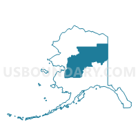
Hughes Precinct, Yukon-Koyukuk Census Area, Alaska
About
Outline

Summary
| Unique Area Identifier | 523568 |
| Name | Hughes Precinct |
| County | Yukon-Koyukuk Census Area |
| State | Alaska |
| Area (square miles) | 3.01 |
| Land Area (square miles) | 3.01 |
| Water Area (square miles) | 0.00 |
| % of Land Area | 100.00 |
| % of Water Area | 0.00 |
| Latitude of the Internal Point | 66.04472200 |
| Longtitude of the Internal Point | -154.23717530 |
Maps


Graphs
Select a template below for downloading or customizing gragh for Hughes Precinct, Yukon-Koyukuk Census Area, Alaska